





The Short Answer
The fastest free live lightning strike map is LightningMaps.org, which shows worldwide strikes updating in real time right in your browser, no download needed. For photographers specifically, the 5 best tools are Photo Expert (a full shooting planner with a built-in lightning map), LightningMaps.org, Blitzortung Lightning Monitor (Android), My Lightning Tracker & Alerts (iOS and Android), and Windy.com (a lightning overlay layered on top of full storm and wind forecasting). A real-time map tells you where a storm cell is right now, which direction it's moving, and how long you likely have to get in position, information you need before you ever touch a camera trigger.
Lightning photography rewards preparation far more than luck. Waiting until you can already see a storm from your window puts you behind from the start: too late to pick a good foreground, too late to find safe shelter, too late to beat the cell to a location with an actual skyline instead of your backyard fence. A real-time lightning strike map solves that, showing you exactly where strikes are happening and which way a system is tracking, minutes or hours before it ever reaches you.
This guide covers the 5 best lightning tracking tools for photographers, how to actually use one to plan a shot rather than just watch dots on a map, and how to pair that planning with a camera trigger once the storm arrives.
Why a Real-Time Lightning Strike Map Matters
A map showing live strikes does three things a weather app alone can't. First, it shows you exactly where lightning is happening right now, not just where storms are forecast to roll through eventually. Second, it lets you watch a cell's direction and speed over several refreshes, so you can figure out whether it's heading toward you, away from you, or along a path that puts a specific foreground element right between you and the strikes. Third, it helps you time your arrival. Show up too early and you're standing around exposed for no reason. Show up too late and you've missed the best light entirely.
What to Look For on a Lightning Map
Not all map features matter equally once you're actually planning a shoot. A few things worth paying attention to on any of these tools:
-
Strike age color coding: most maps shade recent strikes bright yellow or white and older ones progressively darker orange, red, or brown. This lets you read a storm's history at a glance instead of just seeing its current position, and it's the fastest way to tell whether activity is building or fading.
-
Density and clustering: a tight cluster of recent strikes usually marks the active core of a cell, while scattered, isolated strikes often mean a weaker or dissipating system. Prioritize clusters over single outlier strikes when deciding where to point your camera.
-
Refresh rate and delay: every tool here updates quickly, but none are truly instantaneous. Treat the map as accurate to within roughly the last minute or two rather than the literal present moment, especially on free tools running on community sensor networks.
-
Direction and speed of movement: watching the same cluster across two or three refreshes tells you far more than a single snapshot. A cluster spreading and shifting steadily in one direction is a moving storm; one that stays roughly in place while flickering is more likely to sit and dump rain without advancing much.
Choosing the Right Tool for Your Situation
With five solid options, the right pick usually comes down to what you're already doing when a storm rolls in:
-
Something already running in your browser with zero setup: LightningMaps.org. Free, no login, no download.
-
Shooting on Android and want alerts plus 24 hours of history: Blitzortung Lightning Monitor.
-
Push notifications on either iOS or Android without committing to a full planning app: My Lightning Tracker & Alerts.
-
One app that handles your entire shoot, sun, moon, Milky Way, and lightning: Photo Expert.
-
The bigger picture, where a storm system is coming from and how it's developing, not just where it's striking right now: Windy.com.
Best Times to Track Storms
Storm season timing varies by region, but summer afternoons and evenings produce the most reliable activity across most of the US, as daytime heating builds the towering cumulus clouds that eventually turn into thunderstorms. Checking a lightning map in the mid to late afternoon during storm season, rather than waiting until a storm is already visible, gives you the lead time to actually plan a location instead of shooting from wherever you happen to be standing.
Evening storms carry an extra advantage worth planning around: a system that arrives close to sunset lets you combine warm afterglow or a deep blue sky with active lightning in the same frame, a combination that simply isn't available once a storm rolls through at 2 a.m. Checking a map an hour or two before sunset during active storm season is one of the highest value habits you can build into a shooting routine.
The 5 Best Lightning Strike Map Apps and Websites
1. Photo Expert (iOS)
Photo Expert is MIOPS's own photography planning app. It started as a simple sun and moon tracker and has since grown into a full planning tool, real-time Lightning Map included, alongside Milky Way planning, light pollution data, an AR viewer for previewing exactly where the sun or moon will sit in your frame, and calculators for star trails and depth of field. Free to download, with in-app purchases unlocking the premium planning tools, Lightning Map among them. It's the best pick if you want one app that plans an entire outing, not just tracks storms.
2. LightningMaps.org
LightningMaps.org is a free, browser-based real-time lightning map built on data from the Blitzortung.org community sensor network. Nothing to download, no login, no cost. Open it on any device and you get a live global view of strikes with a short animation trail showing recent activity. It's the fastest way to check activity in a specific region without installing anything.
3. Blitzortung Lightning Monitor (Android)
Blitzortung Lightning Monitor is a free Android app built on the same Blitzortung.org data as LightningMaps.org, with over a million downloads. It adds what the browser map skips: a 24-hour history view, color coding by strike age, an optional alarm that calls out the distance and direction of approaching storms, and lower data usage than running a full browser session. Useful if you're checking updates from a spot with weak signal.
4. My Lightning Tracker & Alerts (iOS and Android)
My Lightning Tracker & Alerts, from developer jRustonApps, is available free with ads or as a low-cost paid version without them, on both iOS and Android. It shows live global strikes and a history of hotspots where lightning strikes most often. The push alerts are the standout feature: a heads up the moment a storm approaches your location, even if you're not watching the app at that moment.
5. Windy.com
Windy built its name on wind and weather forecasting, not lightning, but it now includes a real-time lightning overlay that combines live strike data with radar on the same map, animated over a window from 5 minutes to 12 hours back. Because it sits on top of full weather modeling, it's the strongest option if you want to understand where a storm is coming from and how it's likely to develop, not just where it happens to be striking this second. Free on the web and as a mobile app on iOS and Android.
Prenez des photos presque impossibles en transformant votre appareil photo en un dispositif de capture haute vitesse !Le déclencheur intelligent...

Smart+ | Déclencheur d'appareil photo polyvalent
Pair any lightning map with a camera trigger that detects strikes in 1 millisecond, $259.
How to Use a Lightning Map to Plan a Shot
A map is only useful if it changes what you actually do before you shoot. A few practical ways to turn live data into a better photo:
-
Watch a cell for two or three refreshes before committing to a location. A single snapshot tells you where lightning is now, but watching it move tells you where it's heading, which is what actually matters for positioning.
-
Use the direction of travel to choose your foreground. If a cell is tracking from west to east, get east of your subject so the storm approaches from behind it, giving you strikes appearing to originate near or behind your foreground element.
-
Cross-reference with sunset or blue hour timing. A storm that's going to be in range right around dusk is worth prioritizing over one that will still be an hour out at that point, since the color in the sky adds far more to the shot than an extra hour of waiting.
-
Don't chase a cell that's moving away from you. It's tempting to drive toward visible strikes, but a map showing a cell moving away means you're behind it, not ahead of it, and you'll likely arrive after the best activity has passed.
-
Use a wider view to catch multiple storm cells building at once, which is common during active storm season and can give you a choice of two or three developing systems rather than betting on just one.
Pairing a Lightning Map With a Camera Trigger
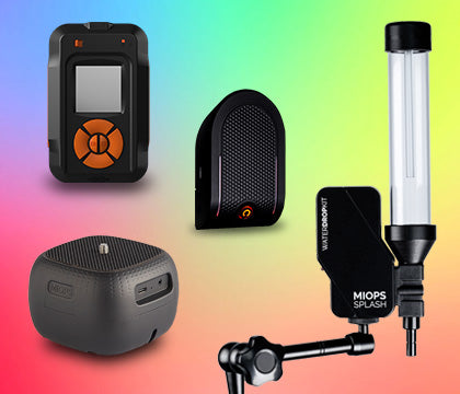
A lightning map tells you when and where to point your camera. It doesn't help you actually catch the strike once you're set up, since a bolt lasts a fraction of a second, faster than anyone can react by hand. That's where a dedicated trigger comes in. The MIOPS Smart+ has a Lightning mode that detects a strike in as little as 1 millisecond and fires your camera automatically, so once your map has told you where to be, the trigger handles the timing. For the full setup process and camera settings, see our guide to Choosing the Right Gear for Lightning Photography, and for the different visual forms lightning takes once you're shooting, see Lightning Types and Classifications.
Staying Safe While You Track and Shoot Storms
A live map is a planning tool, not a safety guarantee. The National Weather Service is clear that if you can hear thunder, you're already within striking range, and that applies even if a map shows the nearest strike several miles out, since lightning can travel well ahead of the visible storm core. Keep a vehicle or solid shelter within easy reach, avoid open fields and isolated tall objects, and treat a remote trigger as a safety feature as much as a creative one, since it lets you step back from your tripod once it's positioned.
Common Mistakes and Why They Happen
Arriving too late to a location almost always traces back to watching a single map snapshot instead of tracking the cell's movement over several minutes. Give yourself more lead time than feels necessary. Setup, focusing, and framing all take longer in the field than they do in your head at home.
Chasing the wrong cell is its own trap. It happens when photographers lock onto the brightest or most active strikes on the map without checking direction of travel first. Activity level matters far less than whether that activity is heading toward your position or drifting away from it.
The most important rule of all: never rely on a map alone for safety decisions. Strike data updates fast, but it isn't instantaneous, and no app replaces basic lightning safety. The moment you hear thunder, that's your cue to take shelter, map or no map.
Frequently Asked Questions
What is the best free lightning strike map?
LightningMaps.org is the best free option that requires no download. It runs in any browser and shows real-time global lightning strikes using data from the Blitzortung.org community sensor network, with no login or cost.
Which lightning tracking app is best for photographers specifically?
Photo Expert stands out for photographers since it combines a real-time Lightning Map with sun, moon, and Milky Way tracking, light pollution data, and photography calculators in one app, rather than just showing strike locations.
Are lightning strike map apps accurate?
Apps built on the Blitzortung.org network, including LightningMaps.org and Blitzortung Lightning Monitor, rely on a large community of ground sensors and are generally reliable for showing recent strike locations, though there's always a short delay between a strike and its appearance on any map.
Can I use a lightning map to know when it's safe to go outside?
Use it as one input, not the final word. The National Weather Service recommends treating any audible thunder as confirmation you're within striking range, regardless of what a map shows for the nearest tracked strike.
Do any of these lightning map apps work offline?
No. All of these tools rely on live sensor data transmitted over an internet or cellular connection, so none of them function offline. Plan around areas with reliable signal if you're tracking a storm from a remote location.
How do I use a lightning map to plan a shot instead of just watching it?
Watch a storm cell over a few map refreshes to establish its direction and speed, then position yourself ahead of its path with a foreground element that will sit between you and the incoming strikes, rather than reacting only once lightning is already visible.
What does the color coding on a lightning map mean?
Most maps shade the most recent strikes bright yellow or white and fade older ones through orange, red, and brown as they age. Reading that gradient tells you at a glance whether a storm's activity is building, holding steady, or already fading.
Is Windy.com only for wind forecasting?
No. Windy started as a wind visualization tool but now includes a real-time lightning overlay layered on top of radar, along with full weather modeling, which makes it useful for understanding how a storm is developing, not just where it's currently striking.
Keep Exploring
Related reading: Lightning Types and Classifications
Related reading: Choosing the Right Gear for Lightning Photography
More gear and tips for storm season.
Sources
National Weather Service: lightning safety and strike distance guidance: https://www.weather.gov/safety/lightning-science
LightningMaps.org: https://www.lightningmaps.org/
Blitzortung Lightning Monitor on Google Play: https://play.google.com/store/apps/details?id=org.blitzortung.android.app
My Lightning Tracker & Alerts on the App Store: https://apps.apple.com/us/app/my-lightning-tracker-alerts/id1175031987
Photo Expert on the App Store: https://apps.apple.com/us/app/photo-expert-sun-moon-tracker/id1635539863
Windy.com real-time lightning tracking: https://www.windy.com/articles/28646