



The Short Answer
A lightning tracker shows you where strikes are being detected in near real time, usually within 20 seconds of the flash. That data comes from one of two places: NOAA's Geostationary Lightning Mapper, which watches the Americas optically from orbit, or ground-based sensor networks that triangulate the radio pulse each strike emits.
For photographers, a tracker answers the question that decides whether you get the shot. Is this cell coming toward me, and how long do I have? Watch a cluster across two or three refreshes to read its direction and speed. Position yourself ahead of its path with a foreground worth shooting. Then let a trigger like the MIOPS Smart+ handle the millisecond timing once the storm arrives.
Most people find a lightning tracker because they want to know whether it's safe to go outside. Photographers use the same tool for the opposite reason. The map isn't telling you when to take shelter. It's telling you where to set up, how much time you have to get there, and whether the storm is worth the drive at all.
This guide covers four things: how lightning detection actually works, what the colors and clusters on a tracker mean, how to read that data as a shot plan rather than a weather report, and how to pair it with a camera trigger.
Why Tracking Beats Waiting
Reason 1: By the Time You See It, You're Late
If your storm-detection method is looking out the window, you've already lost the useful part of the lead time. A cell visible from your house is typically minutes away, which is not enough to choose a location, drive to it, set up a tripod, dial in focus, and compose a frame. A tracker extends that window from minutes to hours, and that extra time is where good compositions come from.
Reason 2: Storm Direction Decides Your Composition
Knowing lightning is happening 20 miles away is only half the information. What matters is which way the cell is moving, because that determines whether your foreground ends up between you and the strikes or behind you. Get that wrong and you'll spend the night photographing an empty sky while the storm lights up the horizon behind your back.
Reason 3: Not Every Storm Is Worth Chasing
Some cells produce steady, frequent strikes for an hour. Others fire twice and collapse. A tracker gives you the strike density and history you need to tell those apart before you commit two hours of driving to a system that's already dissipating.
How a Lightning Tracker Actually Detects Strikes
Nearly every lightning map you'll open draws on one of two detection methods, and the difference explains most of what you'll notice about accuracy, coverage, and delay.
Satellite Detection: NOAA's Geostationary Lightning Mapper
The Geostationary Lightning Mapper, or GLM, is an optical instrument aboard NOAA's GOES satellites. It watches for the momentary flashes of light that lightning produces, and it was the first operational lightning mapper ever flown in geostationary orbit.
Four of its specifications matter directly to photographers:
-
It sees everything, not just ground strikes. GLM measures total lightning, which includes in-cloud and cloud-to-cloud activity alongside the cloud-to-ground bolts you're trying to photograph.
-
It catches 70 to 90 percent of flashes, day or night. Good, but not perfect, so a quiet patch on the map isn't proof of no lightning.
-
Resolution is roughly 10 km. Precise enough to tell you which storm cell is active, not precise enough to tell you which field a bolt landed in.
-
Latency is about 20 seconds. Fast, though still the recent past rather than this instant.
There's one more detail worth knowing, and NOAA highlights it for forecasters rather than photographers. Storms about to turn severe show a significant jump in total lightning activity, often many minutes before radar picks up the same signal.
Translated for our purposes: a rising strike count means a cell is intensifying. That's the cell you want to be pointed at.
Ground Networks: Detecting the Radio Pulse
The other approach listens rather than looks. Every lightning discharge emits a burst of radio energy in the very low frequency range, roughly 3 to 30 kHz. Ground stations record about a millisecond of each of these pulses, timestamp it to microsecond precision using GPS, and send it to central servers.
By comparing when that same pulse arrived at several stations, the network calculates where the discharge happened. The technique is called time of arrival. Blitzortung.org, the volunteer-run network behind many free lightning maps, operates more than 500 receivers this way and reports an average delay of 3 to 20 seconds.
Neither method is strictly better. Satellite detection gives consistent wide-area coverage, including over oceans and mountains where ground stations are sparse. Ground networks can be extremely precise where station density is high.
What both share is a short but real delay. That's the single most important thing to understand about any tracker.
How to Read a Lightning Tracker Like a Photographer
Opening a map and seeing dots is not the same as knowing what to do. Four things are worth reading carefully.
Strike Age
Most trackers color-code strikes by how recently they were detected, typically fading from bright white or yellow through orange and red to dark brown as the minutes pass. That gradient is a history of the storm, not just a snapshot. A cluster that's mostly bright means activity is happening now. A cluster that's mostly dark means you're looking at where a storm used to be.
Density and Clustering
A tight, dense cluster of recent detections marks the electrically active core of a cell. Scattered, isolated strikes across a wide area usually mean a weakening or disorganized system. When you're deciding where to point a camera, prioritize the dense clusters and largely ignore the outliers.
Direction and Speed of Travel
This is the reading that actually changes your decisions, and it requires patience. Watch the same cluster across two or three refreshes rather than reacting to one frame.
A cluster shifting steadily in one direction is a moving storm you can get ahead of. A cluster that flickers in roughly the same place is more likely to sit and rain without advancing, which is usually the less photogenic option.
Latency, and Why It Matters
Every tracker shows you the recent past. Twenty seconds is fast, but it isn't now, and provider or network delays can stretch it further. Treat the map as accurate to within roughly the last minute.
For planning where to drive, that's plenty. For deciding whether it's safe to stand where you are, it isn't. More on that below.
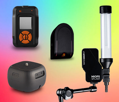
Take almost impossible photos by turning your camera into a high-speed capture device! MIOPS Smart Trigger is a versatile camera...

Smart+ Multi-Mode Camera Trigger | Lightning, Sound, Laser and Timelapse
Detects a strike in as little as 1 millisecond and fires your camera automatically
Turning Tracker Data Into a Shot Plan
The point of all this is a photograph. A few ways to convert what's on screen into decisions in the field:
-
Establish direction first, location second. Identify which way the cell is tracking, then pick a spot that puts your intended foreground between you and the storm's approach path.
-
Give yourself more lead time than feels necessary. Driving, parking, walking in, setting up, focusing, and composing all take longer than you estimate, and a storm doesn't wait while you find your remote cable.
-
Cross-reference with sunset. A cell arriving near dusk lets you combine warm afterglow or deep blue sky with active lightning, which is far more compelling than the same strike against pure black at 2 a.m.
-
Watch strike counts, not just positions. A cluster whose detection rate is climbing is a cell that's intensifying and likely to keep producing. One that's thinning out is winding down regardless of how impressive it looked ten minutes ago.
-
Don't drive toward a cell that's moving away. If the map shows the cluster receding, you're behind the storm and will arrive after the best activity. Let it go and watch for the next one.
Tracking Storms With Photo Expert
Most lightning trackers are built for people who want to avoid storms. Photo Expert, MIOPS's own planning app for iOS, approaches the same data from a photographer's side of the problem. Alongside a real-time Lightning Map, it includes:
-
Sun and moon tracking, plus a Milky Way planner
-
Light pollution data for night work
-
An AR viewer that previews where the sun or moon will sit in your frame
-
Calculators for star trails, depth of field, and long exposures
The practical advantage is having storm data and light data in one place. Knowing a cell will reach you at 8:40 p.m. is useful. Knowing that 8:40 p.m. falls fifteen minutes after sunset, with the sky still holding color, is what tells you to go.
Photo Expert is free to download. The Lightning Map and other premium planning tools are available through in-app purchase.
From Tracker to Trigger: Catching the Strike
A tracker gets you to the right place at the right time. It does nothing for the moment the bolt actually appears, and that's a separate problem.
A lightning flash is over in a fraction of a second, well inside human reaction time. Press the shutter when you see one and you'll photograph an empty sky. The MIOPS Smart+ solves this with a dedicated Lightning mode that detects a strike in as little as 1 millisecond and fires your camera automatically.
Setup is quick. Set the mode to Lightning and start with sensitivity around 1 to 2 percent, then adjust: raise it if dimmer strikes are being missed, lower it if ambient light or distant flashes are triggering frames you can't use.
For the full setup, including lens choice, tripods, weatherproofing, and exposure settings, see our guide to choosing the right gear for lightning photography. If you want to understand what you're actually looking at once the storm arrives, lightning types and classifications covers the different forms a strike can take and how each one changes your composition.
Using a Tracker Safely
A lightning tracker is a planning tool. It is not a safety instrument, and treating it as one is how photographers get hurt.
The National Weather Service is unambiguous. No place outside is safe when thunderstorms are in the area, and if you can hear thunder, lightning is close enough to strike you. Their guidance is to move to a substantial building with electricity or plumbing, or an enclosed metal-topped vehicle with the windows up, and stay there for at least 30 minutes after the last thunder.
That 30 minute figure catches people out. A storm looking finished is not the same as a storm being finished, and a map showing no recent strikes is not an all-clear, especially given detection delay.
NWS also advises staying away from:
-
Elevated terrain such as ridges, hills, and peaks
-
Isolated trees, cliffs, and rocky overhangs
-
Ponds, lakes, and other bodies of water
-
Conductive structures like barbed wire fences, power lines, and windmills
Read that list against a typical lightning composition and the tension is obvious. Exposed ridgelines, lone trees, and water reflections are exactly what makes these photographs work.
The workable answer is distance and shelter. Compose those elements from inside a vehicle or a building, set the camera up during a lull, and let a remote trigger do the waiting instead of you.
Common Mistakes and Why They Happen
Reading a single map refresh is the most frequent error, and it leads directly to arriving at the wrong place. One frame tells you where lightning is. Two or three tell you where it's going, which is the only part that affects your decision.
Chasing the brightest cluster without checking direction is a close second. Intensity is seductive on a map, but a very active cell moving away from you is worth less than a moderate one heading your way.
Assuming coverage is uniform will occasionally catch you out too. Satellite detection reaches to roughly 52 degrees north, and ground network precision depends on how many stations are nearby, so a sparse-looking map in a remote area may reflect detection limits rather than an absence of lightning.
Finally, treating an empty map as permission to stand in an open field is the mistake that actually matters. Detection delay, partial flash detection rates, and the simple physics of a strike traveling well ahead of a storm core all mean the map can look calm while you are not safe.
Frequently Asked Questions
What is a lightning tracker?
A lightning tracker is a map or app that shows where lightning strikes are being detected in near real time. The data comes either from NOAA's Geostationary Lightning Mapper, which detects flashes optically from orbit, or from ground-based sensor networks that locate strikes by triangulating the radio pulse each discharge emits.
How accurate are lightning trackers?
NOAA's Geostationary Lightning Mapper detects 70 to 90 percent of flashes day and night at roughly 10 km spatial resolution, with about 20 seconds of product latency. Ground networks can be very precise where station density is high. Either way, a tracker shows the recent past rather than the exact present, so treat it as accurate to within about the last minute.
Can a lightning tracker tell me if it's safe to go outside?
No. Use it for planning, not safety decisions. The National Weather Service advises that no place outside is safe during a thunderstorm, that audible thunder means lightning is close enough to strike you, and that you should stay sheltered for at least 30 minutes after the last thunder. Detection delay means a quiet-looking map is never an all-clear.
How do I track lightning strikes for photography?
Watch a strike cluster across two or three map refreshes to establish its direction and speed, then position yourself ahead of its path with a foreground element between you and the approaching storm. Cross-reference the arrival time with sunset for better light, and set up well before the cell reaches you.
What's the difference between a lightning tracker and weather radar?
Radar shows precipitation. A lightning tracker shows electrical activity. They often overlap, but not always, and total lightning tends to increase minutes before radar indicates a storm is becoming severe, which makes a tracker a useful early signal that a cell is intensifying.
Does a lightning tracker work everywhere?
Coverage varies by method. NOAA's Geostationary Lightning Mapper covers the Americas and adjacent oceans up to roughly 52 degrees north latitude. Ground-based networks depend on how many volunteer stations operate in a region, so precision is strongest in areas with dense station coverage.
Do I still need a camera trigger if I have a lightning tracker?
Yes, they solve different problems. A tracker tells you where and when to set up. A trigger catches the strike itself, which lasts a fraction of a second and is far faster than human reaction time. A tracker without a trigger usually means being in the right place and still missing the frame.
Keep Exploring
Related reading: 5 Best Real Time Lightning Strike Map Apps and Websites
Related reading: Lightning Types and Classifications
Related reading: Choosing the Right Gear for Lightning Photography
Gear, settings, and technique for storm season.
Sources
NOAA and NASA GOES-R Program: Geostationary Lightning Mapper instrument specifications, detection rates, resolution, and latency: https://www.goes-r.gov/spacesegment/glm.html
Blitzortung.org: VLF detection method, time of arrival technique, network size, and reported delay: https://www.blitzortung.org/en/cover_your_area.php
National Weather Service: lightning safety guidance and the 30 minute rule: https://www.weather.gov/safety/lightning-tips
MIOPS Smart+ product page: lightning detection speed and camera compatibility: https://www.miops.com/products/smart